
by Data4Good | May 23, 2022 |
by Liz Kimbrough, Mongabay In the world’s largest rainforest, wildlife crawls, hops, flies and prowls through every nook and cranny. Most animals are adept at hiding from humans, though, so finding them can be tough. To do so, many researchers rely on camera traps —...

by Data4Good | May 5, 2022 |
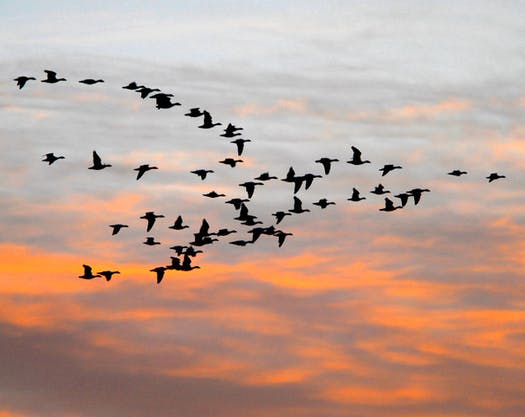
By Joshua Sokol, Science.org City lights lure migratory birds, with lethal results, but weather radar and modeling can help reduce toll Every 11 September at dusk, in memory of the 2001 attacks, New York City mounts the Tribute in Light, an art installation in lower...

by Data4Good | May 4, 2022 |
By Mark Say, Managing Editor, UKAuthority The British Geological Survey (BGS) has unveiled a package of geographic datasets to support management of the national coastline. Named GeoCoast, the dataset provides information on the morphology, behaviour and vulnerability...
by Data4Good | May 4, 2022 |
By Jim Williams, Special to the Star Tribune BirdCast provides live and local bird migration alerts throughout the country with real-time analysis of bird migration traffic as detected by the U.S. network of weather surveillance radars. This tool can be used to...

by Data4Good | Mar 30, 2022 |
By Shourjya Mookerjee, Associate Editor, GCN The four winning teams developed digital tools designed to help local decision makers use federal data for better climate resilience planning. Since the 1980s, multi-billion dollar climate disasters in the U.S. have...
by Data4Good | Mar 30, 2022 |
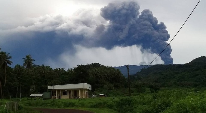
by Beyond Essential In disaster response, getting information to the right people as quickly as possible is absolutely critical. This is where Tupaia is helping. Tupaia provides a map pinpointing every health facility across ten countries in the Pacific When a...