by Robin de Vries, Geospatial Analyst
To solve the plastic pollution problem, we must first understand its dimensions. Knowing how much and what kind of plastic has accumulated in the ocean garbage patches is especially important.
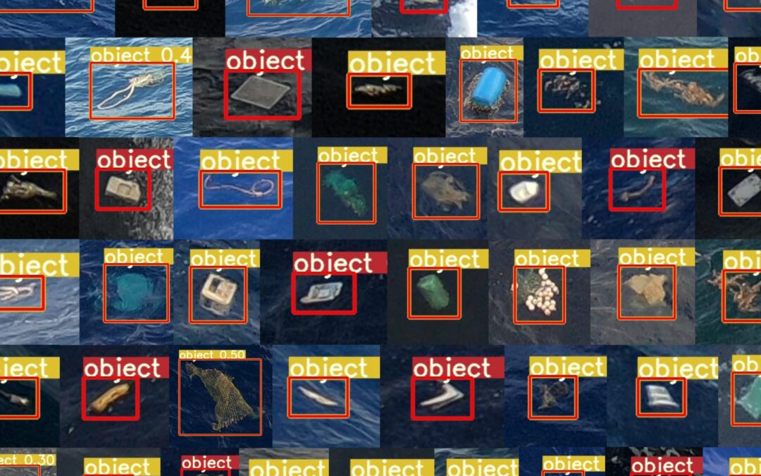
A key objective for our Research Team is to provide data-driven insights to help us determine optimal locations for cleanup operations. New technology and tools that use artificial intelligence (AI) are helping us to create detailed maps of plastic densities in remote ocean locations. The current datasets were built using conventional methods (trawls) that are very labor-intensive, or less conventional methods (airplane) that are very costly and complex to organize.
Using GoPro cameras on ships, we successfully scanned a track of hundreds of miles for marine debris. We processed the dataset with our new AI object detection algorithm, which revealed more than 400 large plastic items in the GPS-tagged images taken by the cameras. By analyzing the item locations, we distilled a numerical concentration map.
Your article helped me a lot, is there any more related content? Thanks!
Your article helped me a lot, is there any more related content? Thanks!